USA - Illustrated Geography Atlas 2.1
Paid Version
Publisher Description
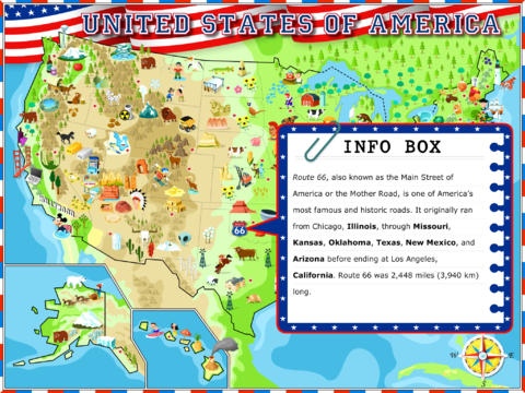
A highly educational interactive app with lots to learn and discover learn about US geography in a fun and engaging way. Explore an exciting illustrated map of the USA and discover nearly 200 natural wonders, historical places, monuments, buildings and state symbols all with fascinating facts and information. Learn using interactive maps, cool to know facts, references and interactive games. Touch any icon, state, landform or river to learn and know more about it. All information and fun facts are very accessible for the target age group. Get to know the shapes, locations, capitals and a lot of facts and figures about each of the 50 states. ***** What reviewers are saying about the USA Illustrated Geography Atlas: * Best of the Best, Editor's choice - bestappsforkids.com * Today's Best Apps - appadvice.com * Top Five Summertime Apps - funeducationalapps.com * "Any teacher who teaches American social studies/geography will greatly benefit from this app. Kids will be engaged, and will definitely learn well." - teachingwithipad.org * "Great app with lots of content perfect for teaching geography... Aligns with common core standards..." - theimum.com * "... impressive amount of interaction. " - appsforclass.com ***** Features: - 8 different interactive maps - Comprehensive data covering elementary US geography - 6 game activities - Retina display support - Audio features - voiceovers with names of states, capitals, cities, mountains, rivers and icons - Interactive & easy-to-use interface - Parents section - No ads or in-app purchases Maps: - illustrated map of the USA containing nearly 200 colorful cartoon images related to each state, showing places and landmarks with cool facts and descriptions - map of states and their capitals - find information in Fact Boxes - nicknames, mottos, abbreviations, dates of admission to the Union, capitals, largest cities, populations, geography facts, state symbols, flags, seals, and much more. - U.S. time zones with a description of each zone. Also find out more about UTC and GMT. - top 30 cities - learn where the major cities are located and how many people live there. - U.S. sports teams map - learn the names and locations of all teams from the NBA, NHL, NFL and MBL. - map of mountain ranges including descriptions, plus a scrollable list of the 20 highest mountains and the states where they are located. - map of major rivers - every river with a description plus a list of the 10 longest rivers. - physical map. Games: - Trivia - Show what you have learned in the app. Read a sentence and choose the missing word from three available - of course you have to get the right word :-) - Find on a map - Drag & drop state capitals or state names to their positions on a blank map of the USA. - Matching pairs - Find pairs for each of the states - shape and flag, shape and seal, or seal and flag. - States & capitals - Match the shape of the state with its name and capital city. - Puzzle - put the puzzle pieces of the U.S. states into the correct locations on a map of the USA. - Spell the state - show you can spell the names of each of the 50 U.S. states. Reward system - You earn stars in every game. Collect 50 stars and get US geography expert badges. The app was created in collaboration with teachers and it meets common core standards, so it s great for use in schools or at home. Educational customers can use a 50% discount through Volume Purchase Program. It is a definite must-have US geography app. It covers several areas of the curriculum - geography, history, reading skills. There are no in-app purchase links, ads, or links to social media, so children will not be distracted from the educational content. Please email us at info@nextwell.com for any help & suggestions or ideas. If you like the app please leave us a review. Visit us: http://www.cooledoo.com Like us: http://www.facebook.com/CoolEdoo
Requires iOS 5.1.1 or later. Compatible with iPad.
About USA - Illustrated Geography Atlas
USA - Illustrated Geography Atlas is a paid app for iOS published in the Kids list of apps, part of Education.
The company that develops USA - Illustrated Geography Atlas is NEXTWELL s.r.o.. The latest version released by its developer is 2.1.
To install USA - Illustrated Geography Atlas on your iOS device, just click the green Continue To App button above to start the installation process. The app is listed on our website since 2014-03-18 and was downloaded 7 times. We have already checked if the download link is safe, however for your own protection we recommend that you scan the downloaded app with your antivirus. Your antivirus may detect the USA - Illustrated Geography Atlas as malware if the download link is broken.
How to install USA - Illustrated Geography Atlas on your iOS device:
- Click on the Continue To App button on our website. This will redirect you to the App Store.
- Once the USA - Illustrated Geography Atlas is shown in the iTunes listing of your iOS device, you can start its download and installation. Tap on the GET button to the right of the app to start downloading it.
- If you are not logged-in the iOS appstore app, you'll be prompted for your your Apple ID and/or password.
- After USA - Illustrated Geography Atlas is downloaded, you'll see an INSTALL button to the right. Tap on it to start the actual installation of the iOS app.
- Once installation is finished you can tap on the OPEN button to start it. Its icon will also be added to your device home screen.
